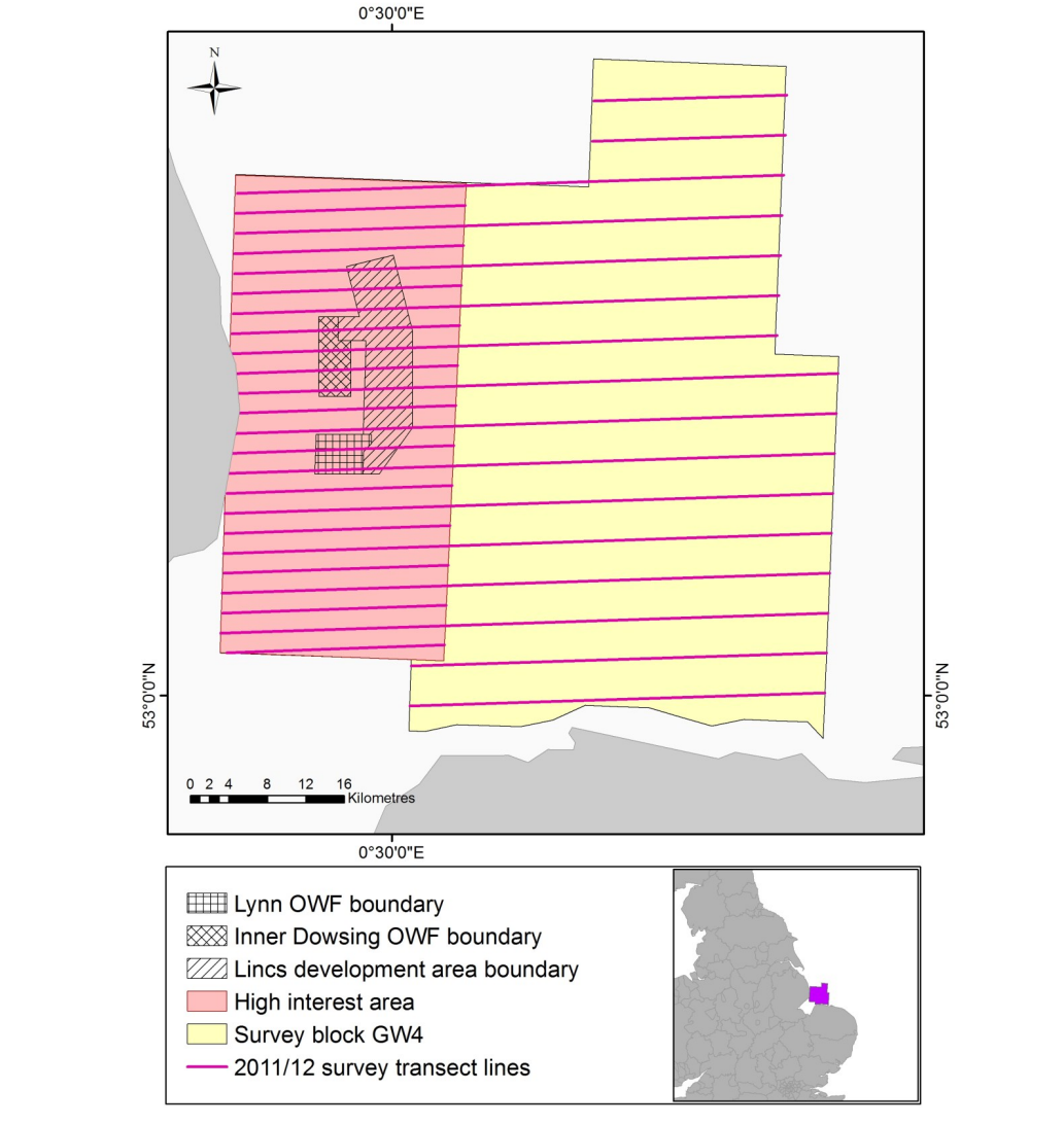
2011-2014, HiDef, Inner Dowsing - Lynn - Lincs, Digital Aerial Bird Surveys

2011-2014, HiDef, Inner Dowsing - Lynn - Lincs, Digital Aerial Bird Surveys

Powered by: TCE
Don't show this

What is a series page?

Download MEDIN file

Last series update:

May 2023

Collection date:

January 2011 - December 2014

The collection date represents the period of data collection or study duration. For example: '16/04/2015-05/05/2015'

Publication date:

May 2023

The publication date is the date the series was published on the Marine Data Exchange. For example: '23/04/2017'

Published by:

The Crown Estate

Summary

HiDef Aerial Surveying Limited (HiDef) was commissioned to undertake digital video aerial surveys as part of a programme to monitor the effects of the construction and operation of the Inner Dowsing, Lynn and Lincs Offshore Wind Farm projects on seabirds.  
The objectives were established in an Ornithological Monitoring Plan (OMP) (Centrica, 2013) ...

Categories:
Birds
Categories indicate the area of study or data type the series is associated with. For example, a survey carrying out grab sampling would have the category 'Benthic Ecology', while a desktop study exploring the impact of substation design on bird nesting would have the categories ' Birds, Engineering Design'
Available in this series:
Data Highlights
1
Datasets
5
Reports
8

Data Highlights


Explore the wealth of the data gathered in the 2011-2014, HiDef, Inner Dowsing - Lynn - Lincs, Digital Aerial Bird Surveys


5

Inner Dowsing, Lynn & Inner Dowsing and Lincs Offshore Wind Farms, Digital Aerial Bird Surveys 2011-2014