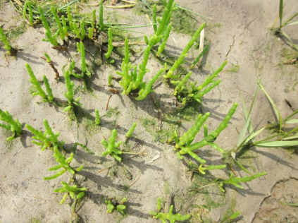
2010-2012, Royal Hakoning DHV, Thanet, Saltmarsh Recovery Monitoring Survey

2010-2012, Royal Hakoning DHV, Thanet, Saltmarsh Recovery Monitoring Survey

Powered by: TCE
Don't show this

What is a series page?

Download MEDIN file

Last series update:

August 2022

Collection date:

March 2010 - September 2012

The collection date represents the period of data collection or study duration. For example: '16/04/2015-05/05/2015'

Publication date:

August 2022

The publication date is the date the series was published on the Marine Data Exchange. For example: '23/04/2017'

Published by:

The Crown Estate

Summary

The Thanet Offshore Wind Farm (TOW) project is located approximately 11.3km off Foreness Point, the most easterly part of Kent (see Figure 1.1) and its cable landfall is located within Pegwell Bay (BNG 634585 E 163850 N). The cable corridor crosses intertidal habitat before following the alignment of the nearby coastal road to Richborough (also loc...

Categories:
Intertidal Ecology
Categories indicate the area of study or data type the series is associated with. For example, a survey carrying out grab sampling would have the category 'Benthic Ecology', while a desktop study exploring the impact of substation design on bird nesting would have the categories ' Birds, Engineering Design'
Available in this series:
Data Highlights
1
Reports
3

Data Highlights


Explore the wealth of the data gathered in the 2010-2012, Royal Hakoning DHV, Thanet, Saltmarsh Recovery Monitoring Survey


6

Saltmarsh Recovery Monitoring Survey 2010-2012